
Montreal
Ski Trails

Printable Map
Montreal Ski Trails - Map Notes
Updated Mar. 11, 2021
The map above has been revised to reflect some updates to the trail that are new. Please note the new routes on Lempi Saari Bypass and Verneren Kuulku. They are fast, fun and will serve as a re-route if the part of grade (now called Ye Older Grade - shown in brown on the map) needs to be closed due to plowing on the private road it runs along.
We are now uploading all of our map information to www.gaiagps.com for your convenience. Feel free to download their free app to your phone to see your position on the trail, track and record your ski trips and access additional information. We’ll ensure that the Gaia maps are always up to date with any changes that may be needed throughout the year!
Check the Home Page and Trail Journal for frequent notes from our intrepid groomers.
Uller
Ski Trail
Printable Map
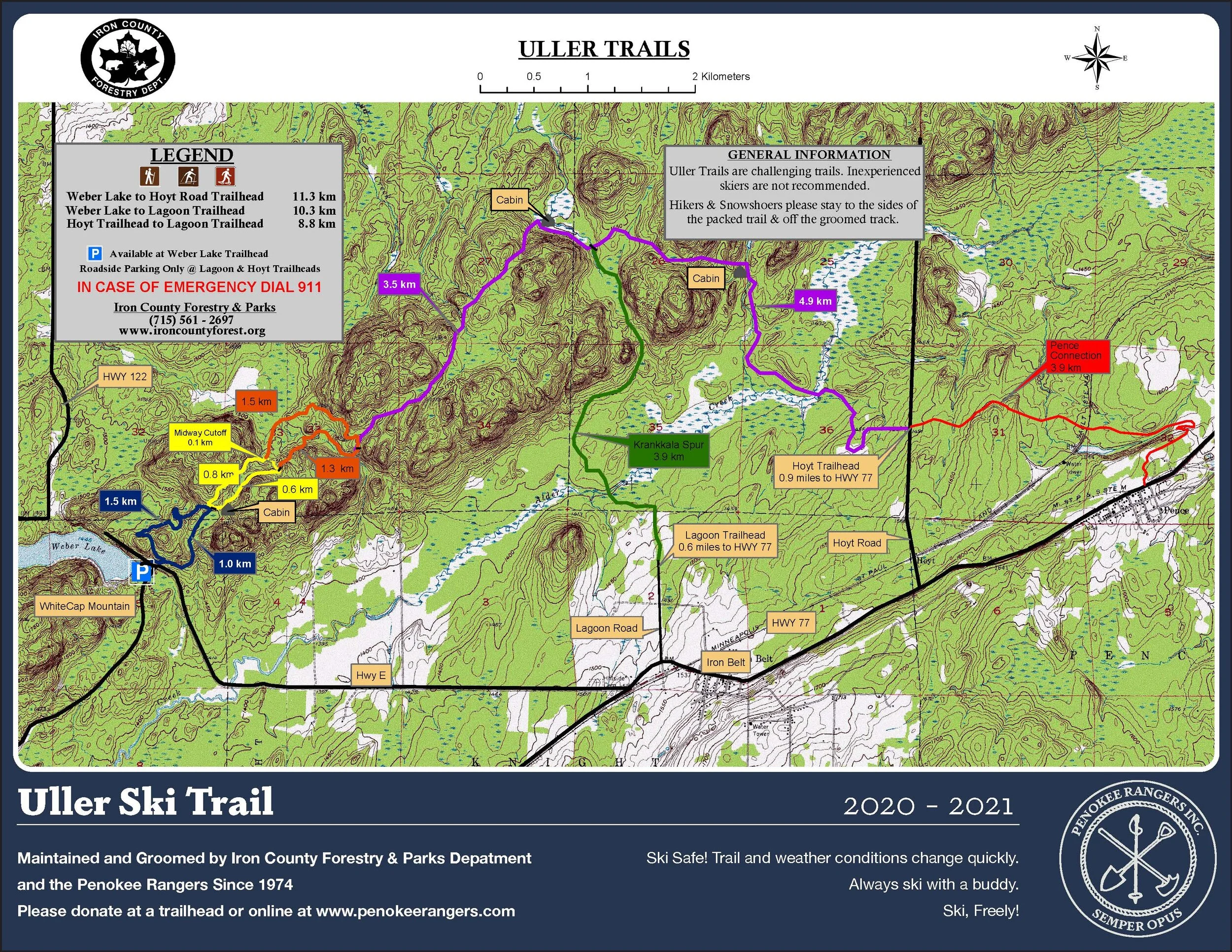
Uller Ski Trails - Map Notes
Updated Mar. 11, 2021
Huge thank-you to the Iron County Forests and Parks Dept. for the map! Click on the map image to access the Gaia page - track your trips!
NOTE! Remember the new Pence Connection for your Uller Trips! The more foot traffic we get out there , the more the new trail will continue to get established. We’re grooming this connector with our old-school snowmobile rigs. It’s a sweet little throwback to the old days.
Check out the Chief of Trail’s map below for the first idea of the new trail. See the map above for the final route.

